Maps
Prints, maps and charts are a fascinating way to give your home a global context or place your interior within a local setting. We specialise in old maps of London including topographical surveys and tube maps. Many of our prints are framed in-house.
13 items found
Page 1 of 1
-
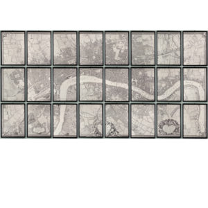
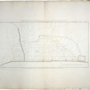
A plan of the cities of London and Westminster, and borough of Southwark,
£4,800 the set of 24 sheetsA plan of the cities of London and Westminster, and borough of Southwark,
The idea to do a new survey had come from the engraver George Vertue, but he and John Rocque could not come to an agreement. Rocque, began the painstaking project in 1737 in partnership with another engraver, John Pine, to survey the central area of London and Westminster, which eventually took 9 years. The completed map measured 6 ½ feet by 13 and comprised of 24 separate sheets. It encompassed an area of 10,000 acres and drawn at a scale of 200ft to the 1inch.£4,800 the set of 24 sheets -
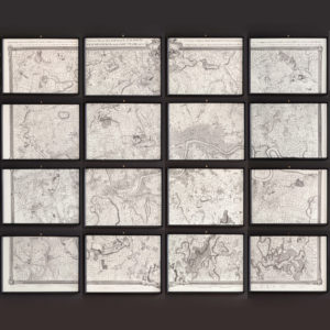
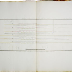
The environs of London in 1746. Impressive sixteen sheet set.
£4,500 the set of sixteen sheetsThe environs of London in 1746. Impressive sixteen sheet set.
John Rocque was of French Huguenot stock from Monosque in Provence. The London he eventually settled in, was an expanding city which had grown unchecked and by the 1730s a new map was needed. Harry Margary, a Senior Civil Scientific Engineer for the Admiralty and self-professed inventor, produced this full-size facsimile of the famous John Rocque map in 1971. The original 18th century map never joined properly due to paper shrinkage in the printing process and only the constituent copper plates joined. For this lithographically printed version Margary altered some of the edges so the maps would join and significantly cleaned up the image area.£4,500 the set of sixteen sheets -

LASSCO Gift card
£25 – £3,000LASSCO Gift card
Redeemable online or at any of the LASSCO stores, our gift cards are the perfect present for anyone. The LASSCO Gift Card is emailed to the recipient on a day of your choosing and they will know its from you as soon as they receive it. Need a present delivered today? Just select the amount you want to send, complete your order and the rest is taken care of.£25 – £3,000 -
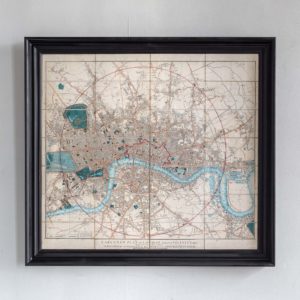
Cary’s New Plan of London and it’s Vicinity 1838
£1,400Cary’s New Plan of London and it’s Vicinity 1838
Detailed map with original hand-colour showing the limits of the two penny postal delivery service. Framed£1,400 -
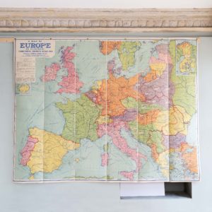
Philips’ A Map of Europe To Illustrate The Territorial Changes Since 1914
£1,200Philips’ A Map of Europe To Illustrate The Territorial Changes Since 1914
The Royal Geographical Society was founded in 1830 as an institution to promote the 'advancement of geographical science'.£1,200 -
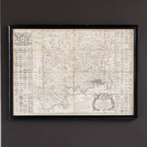
Middlesex by R.W. Seale, c1760
£950Middlesex by R.W. Seale, c1760
Title: 'To the Most Noble / Thomas Holles Pelham / Duke of NEWCASTLE. / Lord Lieutenant of Middlesex & Westminster, His Majesty's / Principal Secretary of State, Chancellor of the University / of Cambridge, & Knight of the Most Noble Order of y e GARTER. / This MAP of the COUNTY of MIDDLESEX / is Dedicated by his grace's most humble Servant / R.W. Seale.£950 -
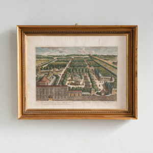
A General Prospect of Vaux Hall Gardens. Shewing at one View the disposition of the whole Gardens. Vüe Détaillee des Jardins de Vaux Hall.
£850A General Prospect of Vaux Hall Gardens. Shewing at one View the disposition of the whole Gardens. Vüe Détaillee des Jardins de Vaux Hall.
Originally engraved by William Simpkins (fl.1784-1825) for Owen Manning and William Bray’s “History and Antiquities of Surrey” (1804-1814).£850 -
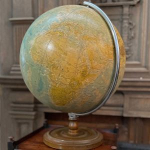
A large English library globe,
£520A large English library globe,
the 19" globe with chromed semi-meridian, mounted on a turned, stained beechwood base, marked and stained with age and use,£520 -
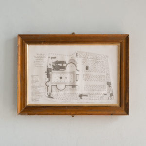
One of a series of plans and drawings referred to in the third report from the select committee upon the improvement of the Port of London
£450One of a series of plans and drawings referred to in the third report from the select committee upon the improvement of the Port of London
A framed print showing Plate XXI - "Copy of a design by Sir Christopher Wren, for re-building the City of London after the Great Fire in 1666, from an original in the library of All-Soul's College, Oxford"£450 -
One of a series of plans and drawings referred to in the third report from the select committee upon the improvement of the Port of London
£300One of a series of plans and drawings referred to in the third report from the select committee upon the improvement of the Port of London
A framed print showing Plate XIII, A - Mr Dance's design - "six modifications of the general form and dimensions of a bridge of five arches"£300 -
Plan of Vauxhall Gardens
£220Plan of Vauxhall Gardens
Originally engraved by William Simpkins (fl.1784-1825) for Owen Manning and William Bray’s “History and Antiquities of Surrey” (1804-1814).£220 -
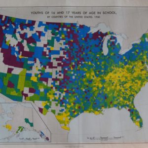
A framed American demographic map
£120 -
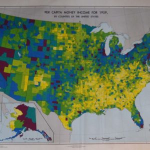
A framed American demographic map
£120A framed American demographic map
'Per Capita Money Income for 1959', in black frame behind acrylic sheet,£120
Featured Items
-
Portraits Part II by Constantin Guys, Verve Vol 2 / No. 5-6.
£500Portraits Part II by Constantin Guys, Verve Vol 2 / No. 5-6.
The Verve Review was a purposefully luxurious. It ran from 1937 to 1960, but with only 38 editions available, due to the high degree of design and editorial work dedicated to each issue. Each edition contained unique lithographic prints, commissioned by the editor, and each cover a double-page lithograph elaborated by one of the artists contained within. It was the brainchild of its editor Stratis Eleftheriades, a Greek National who moved to Paris in the early thirties to take part in the growing Modernist movement, writing under the name of Teriade.£500 -
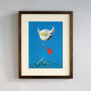
The Moon by André Masson, Verve Vol. 1 / No. 2.
£600The Moon by André Masson, Verve Vol. 1 / No. 2.
The Verve Review was a purposefully luxurious. It ran from 1937 to 1960, but with only 38 editions available, due to the high degree of design and editorial work dedicated to each issue. Each edition contained unique lithographic prints, commissioned by the editor, and each cover a double-page lithograph elaborated by one of the artists contained within. It was the brainchild of its editor Stratis Eleftheriades, a Greek National who moved to Paris in the early thirties to take part in the growing Modernist movement, writing under the name of Teriade.£600 -
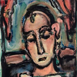
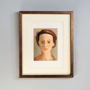
Head of a Girl by George Rouault, Verve Vol 2 / No. 5-6.
£800Head of a Girl by George Rouault, Verve Vol 2 / No. 5-6.
The Verve Review was a purposefully luxurious. It ran from 1937 to 1960, but with only 38 editions available, due to the high degree of design and editorial work dedicated to each issue. Each edition contained unique lithographic prints, commissioned by the editor, and each cover a double-page lithograph elaborated by one of the artists contained within. It was the brainchild of its editor Stratis Eleftheriades, a Greek National who moved to Paris in the early thirties to take part in the growing Modernist movement, writing under the name of Teriade.£800 -
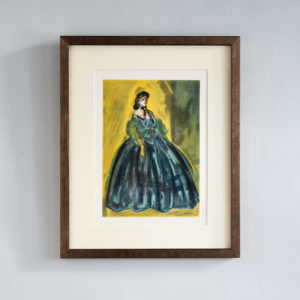
Portrait by Andre Derain, Verve Vol 2 / No. 5-6.
£800Portrait by Andre Derain, Verve Vol 2 / No. 5-6.
The Verve Review was a purposefully luxurious. It ran from 1937 to 1960, but with only 38 editions available, due to the high degree of design and editorial work dedicated to each issue. Each edition contained unique lithographic prints, commissioned by the editor, and each cover a double-page lithograph elaborated by one of the artists contained within. It was the brainchild of its editor Stratis Eleftheriades, a Greek National who moved to Paris in the early thirties to take part in the growing Modernist movement, writing under the name of Teriade.£800