


Philips’ A Map of Europe To Illustrate The Territorial Changes Since 1914
Huge Wall Map, from the Royal Geographical Society map room.
The Royal Geographical Society was founded in 1830 as an institution to promote the 'advancement of geographical science'.
£1,200
In stock
Dissected folding map, backed onto canvas with eyelets for hanging. Published by George Philip & Son Ltd. London, under the auspices of the League of Nations Union. From the Royal Geographical Society. with blind stamp and dated by hand 19th April 1939.
You may also be interested in these items
-
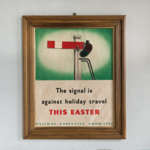
‘The signal is against holiday travel this Easter’
£420‘The signal is against holiday travel this Easter’
Born in Yarmouth, Reginald Mayes’ career began in the design studio of the Eastern Daily Press in Norwich. He moved to London where he designed water marks for paper manufacturers and studied life drawing at the Regent Street Polytechnic and Lithography under Gardiner, Clive. In the early 1930s he became chief staff artist at the London Midland and Scottish Railway public relations department, designing leaflets and posters. In the Second World War, Mayes produced a wide range of anti-travel and propaganda posters for the Railway Executive Committee. They discouraged railway travel with some humorous slogans such as ‘The signal is against holiday travel this Easter’. After the war he did freelance work before retiring to Kent where he relaxed painting landscapes.£420
Recently Viewed Items
-
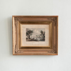
Vauxhall Bridge by Willian Tombleson
£220Vauxhall Bridge by Willian Tombleson
Engraved by Henry Winkles from the original study by William Tombleson. Originally published in the part-work series “Tombleson’s Views of the Thames and Medway” (London : 1833-1834).£220 -
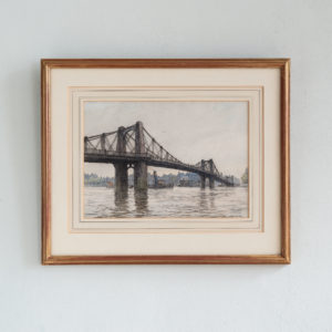
Lambeth Bridge With Shipping
£650Lambeth Bridge With Shipping
Pedestrians idle on the parapet of Old Lambeth Bridge while a steam tug passes beneath the central arch towing a Thames barge. Warehouses, wharves and houses line the Westminster shore. A Framed and mounted mixed media sketch by the artist Hubert Williams showing Old Lambeth Bridge prior to it's demolition in 1928. Signed on the plate by the artist.£650