


Archived Stock - This item is no longer available
1675 antique map showing the roads from Chelmsford to Saffron Walden and Bury,
an original map with hand-colour published c1675 by John Ogilby.
Showing the road from Chelmsford to Saffron Walden. In Hogarth style frame.
SOLD OUT
In stock
John Ogilby (1600-1676) published the first ever road atlas of England & Wales called Britannia. The 100 maps contained within were also the first to work by the principle of one inch to the mile and to use the Statute mile of 1760 yards. Each road map depicts a route in the form of 6 or 7 vertical strips with a compass rose showing orientation; additionally, miles, furlongs, towns, churches, windmills, rivers, hills and even gallows are depicted. In total, about 7500 miles were surveyed for the production of the atlas.
Recently Viewed Items
-
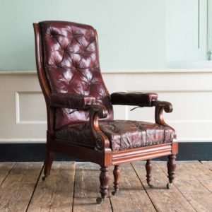
William IV mahogany reclining reading chair,
William IV mahogany reclining reading chair,
upholstered in maroon leather, lacking articulated reading stand. -
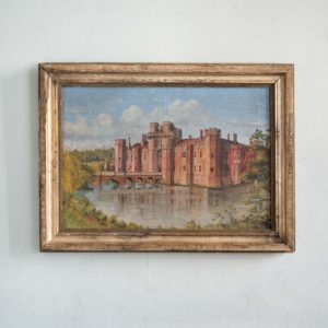
Primitive painting of Herstmonceux Castle
£220Primitive painting of Herstmonceux Castle
The brick-built Herstmonceux Castle dates from the 15th century and is situated in East Sussex four miles inland from Eastbourne. The castle was dismantled in 1777 to become a picturesque ruin until restoration in the early 20th century.£220 -

An Arts & Crafts style oak side table
£230An Arts & Crafts style oak side table
the octagonal top raised on four plank legs with fret-cut trefoil devices,£230