


Recently Viewed Items
-
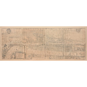
Framed bird’s-eye view showing London in 1560,
Framed bird’s-eye view showing London in 1560,
Civitas Londinum was a bird’s-eye view of London, first printed from woodblocks in about 1561. It was later rediscovered in the 18th century and widely became known as the “Agas map,” from a spurious attribution to surveyor Ralph Agas.
The attribution was made by George Vertue the 18th century antiquarian who produced a copy on pewter plates in 1736 which this reproduction is based on.